Viewing Entries 1 - 6 of 6
Page
1 |
| Image |
Title
Description |
Object
Date |
Accession # |
Location |
|
More Info
|
Kootenai National Forest
'Kootenai National Forest, Montana' (1924) |
MAP
1924 |
1997.019.001 |
MAP DRAWER 5 |
|
More Info
|
Map 297A. Cranbrook Sheet: Kootenay District, BC
Scale 1 inch to 1 mile. Geological Survery, W.H. Collins, Director. Modified British Grid System: Western Canada Zone 3. Legend. |
map : col., printed
1934 |
2008.035.005 |
2-6-4-24 |
|
More Info
|
Canadian Pacific (CP) All Services Map
Highlights Canadian Pacific North American railway routes, hotels and agencies. Shows other railway routes as well. 2 Inset maps showing worldwide CP steamship and airway routes. Reverse side: Layout diagrams and color drawings (interior) of various passenger cars, color drawings of various CP modes of transportation (rail cars, truck, airplane, steamship, etc.). Large color image of "The Canadian" in Bow River Valley, Canadian Rockies. |
textual record : map
1967 |
2008.051.010 |
2-6-5-1 |
|
More Info
|
Cranbrook British Columbia Kootenay Land District Map 82 Second Status Edition
Cranbrook British Columbia Kootenay Land District Map 82 Second Status Edition. Department of Lands, Forests, and Water Resources, British Columbia, Honourable R. A. Williams, Minister. |
textual record : map
April 1974 |
2012.035.012 |
MAP DRAWER 4 |
|
More Info
|
Canadian Rockies Showing Main Line of Canadian Pacific Ry with Branchlines & Steamship Connections
Canadian Rockies Showing Main Line of Canadian Pacific Ry with Branchlines & Steamship Connections Map. |
textual record : map
Unknown |
2012.035.039 |
Archive Storage : Map Drawer 3 |
|
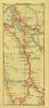
Strip Map from the Alberta Motor Association from 1944 - Banff to Cranbrook
Strip Map from the Alberta Motor Association from 1944 - Banff to Cranbrook, including brief descriptions of items seen on the way. |
textual record : map
1940 |
2012.035.062 |
4-2-8-7 |
Viewing Entries 1 - 6 of 6
Page
1 |