| 2007.040.001 » Twelve Historical New York City Street And Transit Maps, from 1860-1967 |
|
Click to Enlarge
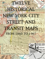
Accession: 2007.040.001 Object: book : softcover, plastic coil binding Title: Twelve Historical New York City Street And Transit Maps, from 1860-1967 Description: 12 Maps from the John Landers Collection with commentary by John Landers. Each map is individually stored in an 'envelope' page with a description written on the front of the 'envelope'.
A loose paper with suggestions of the other books is found inside the front cover.Item Date: 1997 Size: 27 x 19 cm Creator: Landers, John Publisher: H & M Productions II INC. Flushing, New York ISBN / ISSN: 1-882608-16-X Location: PF.0029.0011 Indexed In: Reference » Map
Reference » Book » By Author » Letter L
Transportation & Travel